Tainai Ski and Snowboard area 3D Ski Map
3D Ski Map for Tainai Ski and Snowboard area
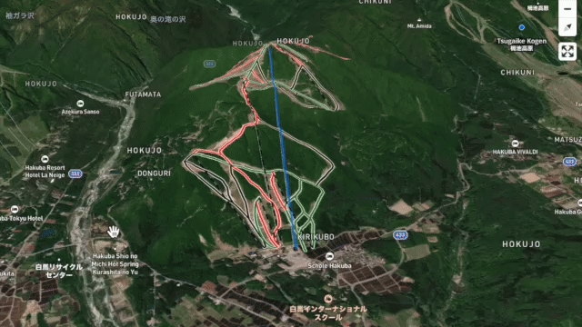
Use this interactive 3D ski map of Tainai Ski and Snowboard area to explore lift locations, piste layouts, terrain steepness, and elevation changes across the mountain. Rotate, zoom, and tilt the map to understand how the resort is laid out before you ski.
 Sample – Please
Register / Login
to view the full 3D map
Sample – Please
Register / Login
to view the full 3D map
Lifts & Piste Breakdown
胎内スキー場 / Tainai Ski and Snowboard area
- Max Elevation: 706 m
- Min Elevation: 144 m
- Ttl Vertical: 562 m
- Lift Length: 7,139 m
- No. of Lifts: 9
-
Piste Length:
11,775 m
Beginner : 46% (5,392m)
Intermediate : 40% (4,661m)
Expert : 6% (734m)
Freeride : 6% (657m)
Unrated : 3% (331m)