This 16-day snow and weather forecast for Lutsen Mountains provides a detailed outlook on upcoming snowfall, temperature trends, wind conditions, and freezing levels. Use this long-range forecast to plan ski days, powder hunts, and travel decisions with confidence as mountain weather patterns evolve over the coming weeks.
47.6586, -90.7193
| Variable | Days Nov 27–Dec 4 · register free | |||||||||||||||||||||||
|---|---|---|---|---|---|---|---|---|---|---|---|---|---|---|---|---|---|---|---|---|---|---|---|---|
| Sunrise | 05:51 | 05:53 | 05:54 | 05:56 | 05:57 | 05:59 | 06:00 | 06:02 | 06:03 | 06:05 | 06:06 | 06:08 | 06:09 | 06:11 | 06:12 | 06:14 | 06:15 | 06:17 | 06:18 | 06:19 | 06:21 | 06:22 | 06:24 |
Unlock the full 16-day forecast
Register to view
Nov 27 – Dec 4
8 more days beyond your 23-day preview
Free account · Lutsen Mountains & 1,000+ resorts
Already registered? Log in |
| Sunset | 15:40 | 15:39 | 15:37 | 15:36 | 15:34 | 15:33 | 15:32 | 15:30 | 15:29 | 15:28 | 15:27 | 15:25 | 15:24 | 15:23 | 15:22 | 15:21 | 15:20 | 15:19 | 15:19 | 15:18 | 15:17 | 15:16 | 15:16 | |
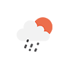
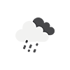
| Rain Sum (mm) | 26.8 | 6.5 | - | - | - | - | - | - | - | - | - | - | - | - | - | 0.4 | 0.1 | 4.8 | 4.1 | - | - | - | - | |
| Snowfall Sum (cm) | - | - | - | - | - | - | - | - | - | - | - | - | - | - | - | - | - | - | - | - | - | - | - | |
| Weather |
|
|

|

|
|
|

|
|
|
|
|
|

|
|
|
|
|
|
|
|
|
|
|
|
| Precipitation Sum (mm) | 26.8 | 6.5 | - | - | - | - | - | - | - | - | - | - | - | - | - | 0.4 | 0.1 | 5.0 | 4.1 | - | - | - | - | |
| Max Temperature (°C) | 13 | 9 | 3 | 8 | 8 | 8 | 11 | 6 | 1 | 2 | 5 | 6 | 8 | 7 | 8 | 8 | 8 | 11 | 8 | -1 | -3 | -2 | 1 | |
| Min Temperature (°C) | 9 | 0 | -1 | -1 | 4 | 0 | 3 | 1 | -3 | -4 | -3 | -5 | -1 | 2 | 4 | 5 | 4 | 8 | -1 | -6 | -8 | -7 | -3 | |
| Max Wind Gusts (km/h) | 44 | 74 | 34 | 32 | 84 | 35 | 51 | 43 | 37 | 29 | 24 | 22 | 48 | 41 | 40 | 50 | 50 | 59 | 37 | 37 | 36 | 29 | 42 | |
| Max Wind Speed (km/h) | 22 | 34 | 16 | 10 | 35 | 12 | 25 | 22 | 17 | 17 | 14 | 9 | 15 | 14 | 13 | 19 | 24 | 19 | 18 | 19 | 19 | 11 | 25 | |
| Dominant Wind Direction (°) | ||||||||||||||||||||||||
| Precipitation Probability (%) | 93 | 87 | - | - | 1 | 5 | - | 9 | 1 | - | - | - | 1 | - | 1 | 6 | 12 | 54 | 30 | 30 | 2 | 10 | 10 | |
|
Freezing Level
Top 519 m
Mid 394 m
Bot 269 m
|

Sknowed.com is a Japan-first ski guide — track snowfall, explore ski maps, and plan powder trips with live forecasts and alerts.
Sknowed for iPhone is coming for the 2026/27 northern winter. Record your ski day, currently free, and it syncs with the website.


 Japan Ski Resorts